As part of my investigation into Stolpersteine, I partook in a course on Programming for Digital Humanities at Linnaeus University in which we focused on the visualisation of data using Python 3.
Using these skills I built a programme to scrape data from Wikipedia regarding Stolpersteine in Kreuzberg, Berlin. Once this had been cleaned and saved as a csv file, additional data was added (wherever possible) about the people who the Stolpersteine commemorate. This data was the iterated through, searching for keywords which could elucidate why each person may have been targeted. Terms included Jude, KPD (Kommunistische Partei Deutschlands), Schwul amongst others. Fields were added to the csv file to record the results.
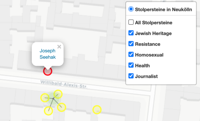
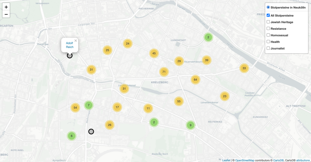
Data regarding locations was turned into geo locations using Google. Each Stolperstein was plotted onto a map using folium and assigned a colour based on the keywords that indicated why a person may have been persecuted by Nazis. The popup for each Stolperstein contains a hyperlink which opens a new browser tab in which the user can read the source material. Stolpersteine are clustered according to locations, which the user can zoom in on, to display the exact locations of Stolpersteine.
Download the html file here, to learn more about Stolpersteine in Kreuzberg: